
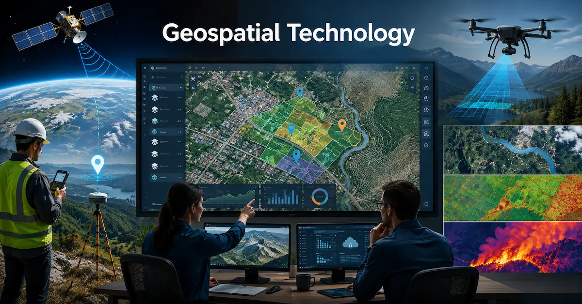
Geospatial technology is the set of tools, sensors, and software that capture, process, and analyze data tied to a specific place on Earth. It combines satellite positioning, remote sensing, and mapping software so a device, a company, or a government agency can answer one question: what is happening, and where. If you’ve used a delivery tracking app, checked a wildfire map, or seen a drone survey a construction site, you’ve already relied on it without thinking twice.
Most articles on this topic stop at definitions and a list of industries. I want to go further: where the real costs hide, which tool actually fits your situation, and the mistakes I’ve watched teams make when they adopt this stuff without a plan.
Where the Confusion Usually Starts: GIS, GPS, and Remote Sensing Aren’t the Same Thing
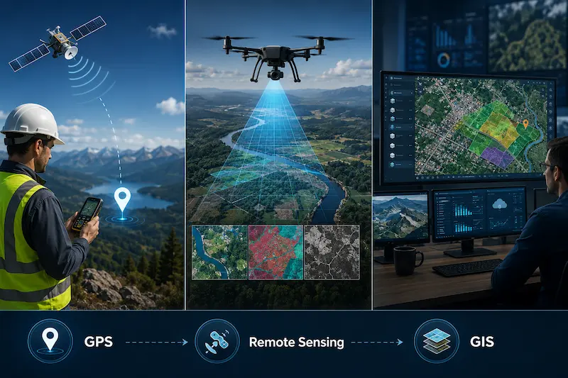
People use these terms interchangeably, and that’s where budgets get wasted. A city planning department once told me they needed “GPS” when what they actually needed was GIS software to analyze data they already had. Here’s the distinction that actually matters when you’re choosing a tool or writing a scope of work:
| Term | What it does | What it can’t do alone |
| GPS | Pinpoints a location using satellite signals | Doesn’t store, layer, or analyze data |
| Remote sensing | Captures imagery or measurements from a distance (satellite, drone, aerial) | Doesn’t interpret patterns or combine with other datasets |
| GIS | Stores, layers, and analyzes location-tagged data from any source | Doesn’t collect raw data on its own |
| Geospatial technology | The umbrella covering all three, plus cartography and spatial analysis | It’s a category, not a single purchase |
If someone pitches you “geospatial technology” as one product, ask which of these three it’s actually handling. Most vendors specialize in one leg of the stool and partner or integrate for the rest.
The Part Nobody Tells You: What It Actually Costs to Get Started
Every explainer article talks applications. Almost none talk budget, and that’s usually the first question a manager asks after reading one of these guides.
If you’re experimenting or working solo:
- QGIS is free, open-source, and genuinely capable for most mapping and spatial analysis work.
- Sentinel Hub and USGS EarthExplorer give you free access to satellite imagery, including Sentinel-2 and Landsat archives.
- A consumer drone with a basic RGB camera runs $1,000 to $3,000 and covers small-site mapping.
If you’re running this for a team or an operation:
- ArcGIS licensing typically scales from a few thousand dollars a year for a small team to well into six figures for enterprise deployments with field apps, imagery add-ons, and cloud hosting.
- LiDAR-equipped drones or terrestrial scanners start around $15,000 to $20,000 and climb fast depending on point density and range.
- Factor in someone’s time to actually run the analysis. Software cost is rarely the biggest line item. Staffing and training usually is.
The mistake I see most often: a team buys enterprise GIS software, then realizes nobody on staff knows spatial analysis, and the tool sits half-used for a year. Buy the tool that matches the skill level you actually have today, not the one your five-year roadmap wants.
A Real Example: How This Plays Out During a Wildfire
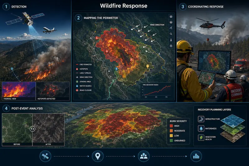
Abstract application lists don’t tell you how these pieces connect under pressure. Here’s how it actually unfolds during a wildfire response, based on how disaster response teams describe their workflow:
- Detection. Satellite thermal sensors and sometimes aircraft-mounted infrared cameras flag hotspots before ground crews see smoke.
- Mapping the perimeter. GIS software pulls in that thermal data along with wind speed, terrain slope, and vegetation dryness to model likely spread direction.
- Coordinating response. Fire crews, evacuation planners, and air support all reference the same live map layer, so nobody is working from outdated information.
- Post-event analysis. After containment, remote sensing imagery measures burn severity and guides where reforestation or erosion control needs to happen first.
That’s four completely different tools working as one system: thermal sensors, GIS software, live data sharing, and post-event imagery. This is the part “applications” lists tend to flatten into a single bullet point, and it’s where the real value shows up.
Common Mistakes Teams Make When Adopting This Technology
I’ve watched the same handful of errors repeat across construction, utilities, and local government projects:
- Collecting data with no plan for who analyzes it. Drone footage sitting unprocessed on a hard drive isn’t geospatial technology, it’s just video.
- Ignoring coordinate system mismatches. Two datasets that look aligned on screen can be off by meters if they’re using different projections. This causes real, expensive errors in construction and land surveying.
- Treating satellite imagery as always current. Free imagery sources often lag by days or weeks. For anything time-sensitive, like active flooding, you need tasked or near-real-time capture, which usually costs more.
- Skipping ground-truthing. Remote data is a model of reality, not reality itself. Field verification catches errors that imagery alone won’t reveal, especially in dense forest canopy or urban shadow zones.
Where This Is Heading in 2026
A few shifts are changing how teams actually use this technology right now, not five years from now:
- AI-assisted feature extraction is cutting the time it takes to identify roads, buildings, or crop boundaries from imagery. Work that used to take analysts days of manual digitizing now takes hours.
- Small satellite constellations mean more frequent imagery revisits, sometimes daily instead of weekly, which matters enormously for agriculture and disaster response.
- Edge processing on drones lets some analysis happen onboard, mid-flight, instead of waiting for a full data download and desktop processing.
- Cloud-based GIS platforms are lowering the entry barrier for smaller teams who previously couldn’t justify enterprise server infrastructure.
None of this replaces the fundamentals. It just speeds up the pipeline between capture and decision.
How to Actually Get Started This Month
If you’re deciding where to begin rather than just reading about it:
- Define the actual question you need answered. Not “we need GIS,” but “we need to know which parcels flood at 2 inches of rainfall.”
- Check what free data already covers your need before buying anything: USGS, Sentinel Hub, and OpenStreetMap are good starting points.
- Try QGIS on a small, real dataset before evaluating paid platforms.
- Talk to someone in your industry who’s already doing this. The workflow gotchas rarely show up in vendor demos.
- Budget for training, not just software. The tool is the easy part.
FAQs
Is geospatial technology the same as GIS?
No. GIS is one component within geospatial technology. Geospatial technology also includes GPS, remote sensing, and cartography working together.
Can I learn geospatial technology without a coding background?
Yes. QGIS and ArcGIS both offer point-and-click interfaces for mapping and basic analysis. Coding (usually Python) becomes useful once you’re automating repetitive tasks or handling large datasets.
What’s the difference between free and paid satellite imagery?
Free sources like Landsat and Sentinel-2 offer solid resolution (10 to 30 meters per pixel) but slower revisit times. Paid providers offer higher resolution and near-daily or tasked captures for time-sensitive work.
Do small businesses actually use geospatial technology, or is it just for governments and large enterprises?
Small businesses use it regularly, often without calling it that. Delivery route optimization, store site selection, and local market analysis all rely on the same underlying tools.
How accurate is drone-based mapping compared to traditional surveying?
Modern drone photogrammetry can reach centimeter-level accuracy with ground control points, which rivals traditional survey methods for many applications. Licensed surveyors are still required for legal boundary work in most places.
What industries are adopting geospatial technology the fastest right now?
Precision agriculture, insurance risk modeling, and renewable energy site planning are seeing the fastest growth, driven largely by cheaper satellite imagery and AI-assisted analysis.
Do I need special hardware to start working with geospatial data?
Not necessarily. A standard laptop can run QGIS and handle most beginner and mid-level analysis. Hardware needs like drones or LiDAR scanners only become relevant once you’re collecting your own field data rather than using existing public datasets.
Is geospatial technology only useful for large-scale or outdoor projects?
No. It’s used for indoor mapping too, including building layouts, retail floor planning, and facility asset tracking, using indoor positioning systems instead of GPS.
